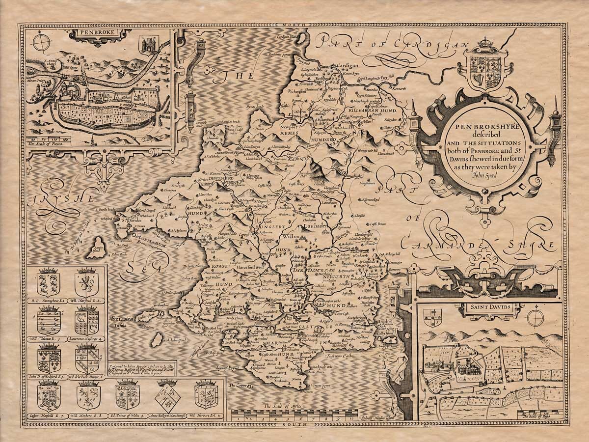
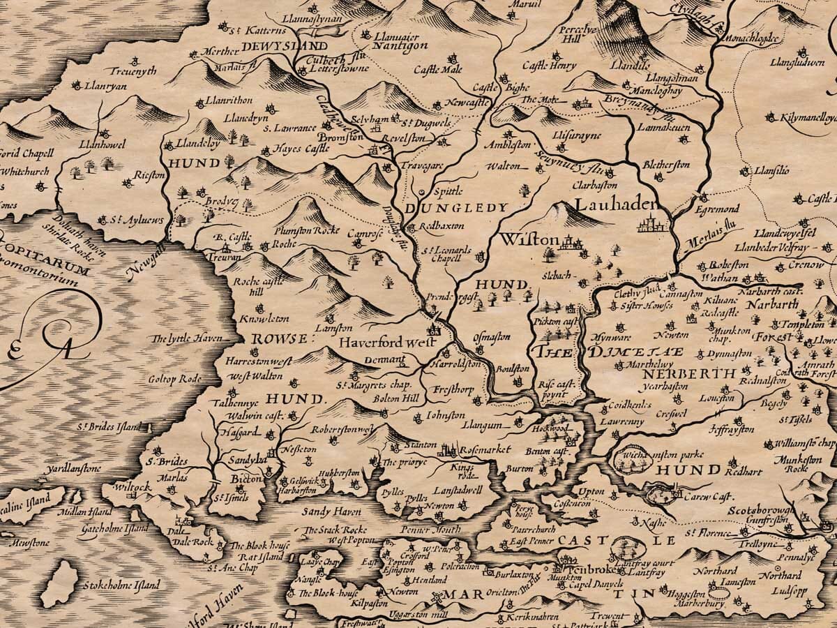
The map of Pembrokeshire clearly represents the counties landscape of hilly uplands to the north and softer plains to the south, together with its varied coast-land with offshore islands, rocks, headland and havens. The county town of Pembroke was tiny. In fact, John Speed commented that Pembroke was ” a city with few inhabitants, and no more houses that inserted in the draught (drawing) yet hath it a fair Cathedral Church”. Even so Henry the seventh, who had been born at Pembroke, was greatly enamoured of the small cathedral city, and the Tudor dynasty bestowed a series of royal favours on it. The town of Pembroke was the first to be incorporated in Wales in 1485 and the shire was chosen for Anne Boleyn’s marquessate before her marriage to Henry VIII.
Authentically aged heavy textured paper • 12 Colour printing technology • Guaranteed to pass or exceed museum quality standards • Bespoke framing service • Free UK Courier Delivery with tracking
Available in three sizes: Large: 24″ x 31″(78.7 x 61cms) Medium: 18″ x 24″(45.5 x 61cms) Small: 19.5″ x 14″ (49.5 x 35.5cms)
A stunning certified FINE ART PRINT on heavy textured art paper — not a poster
Direct from the publisher — no middlemen
Printed in-house in Cornwall
Free UK delivery — international shipping available
Produced to meet — and often exceed — museum-quality standards
Fine Art Map Reproductions – Museum-Quality Printing
Unlike most online offerings, our maps are produced entirely in-house, not outsourced to print-on-demand or drop-shipping services. This allows complete control over quality while offering better value. Each map begins with a high-resolution original, carefully enhanced and printed to order using archival papers and pigment inks for exceptional clarity, depth, and longevity. Every piece is personally overseen — no map leaves our workshop unless it is of a quality we would be proud to display ourselves.
Authentic Old Map Paper & Accurate Colour Reproduction
Paper choice is essential to the authenticity of our maps. We use specially sourced 190gsm paper made in the UK from pure materials and traditionally pressed with natural woollen felts. This process creates a subtle, randomly textured surface that closely resembles an original antique document. Likewise the use of premium quality ink fully saturates the paper, producing remarkable clarity, depth, and historical character. Colour fastness and sharpness will remain good for in excess of 100 years!
Buy Old Maps Online in the UK Today
Trading online since 1999
The Old Map Company of Great Britain offers a vast and carefully curated collection of the very finest expertly reproduced vintage maps. Our range includes works by renowned cartographers such as John Speed and Willem Blaeu, covering Scotland, England, and beyond. Free UK courier delivery is included, with EU, USA, and worldwide shipping available at cost and calculated at checkout. If you need assistance, our team is always happy to help you choose the perfect map.
RECENT REVIEWS
M.F. Leicestershire
Very impressed . . . exceeded my expectations. My son would now like one for Christmas!
Julia Ballester
Very pleased with the quality of the map and it even arrived before it was supposed too.
Nikki
Amazed to find the church where we married on a 400 year old map. Bought as a 1st anniversary gift.
K.H. Middlewhich
I am absolutely delighted with the my antique map. It is so interesting. I would now like to purchase another Map for my sister as a Christmas present.