Additional information
| Dimensions | N/A |
|---|---|
| Size |
£35.55 – £59.95
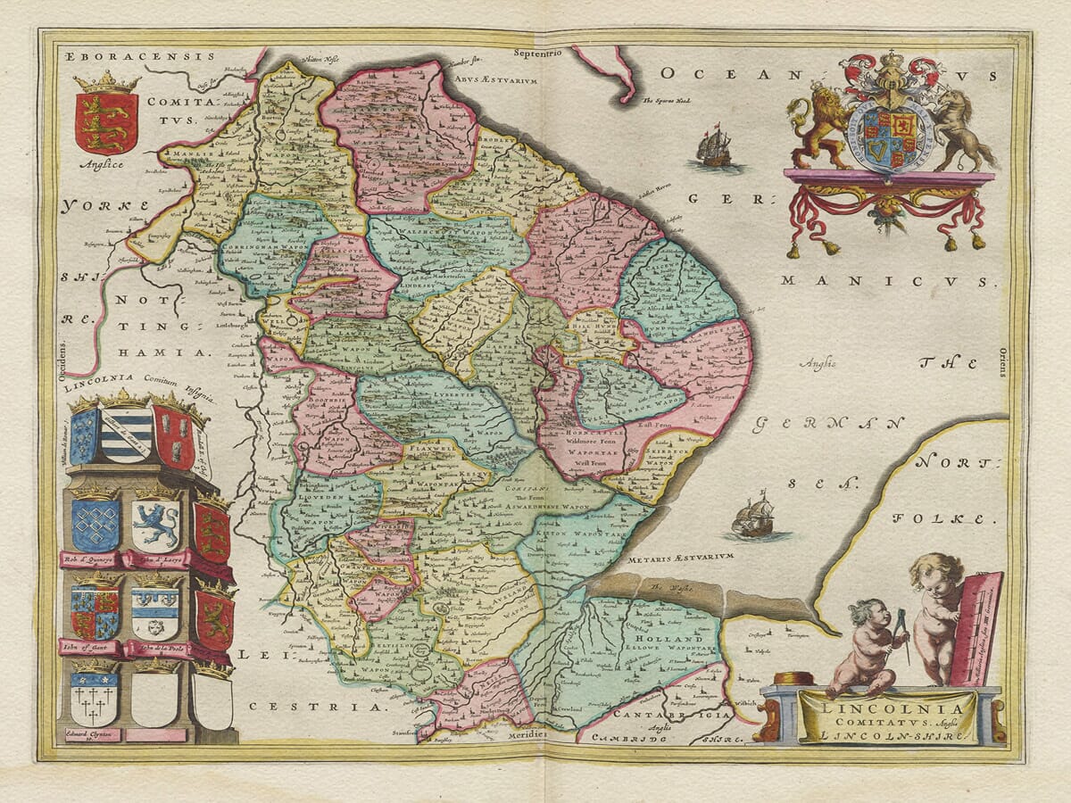
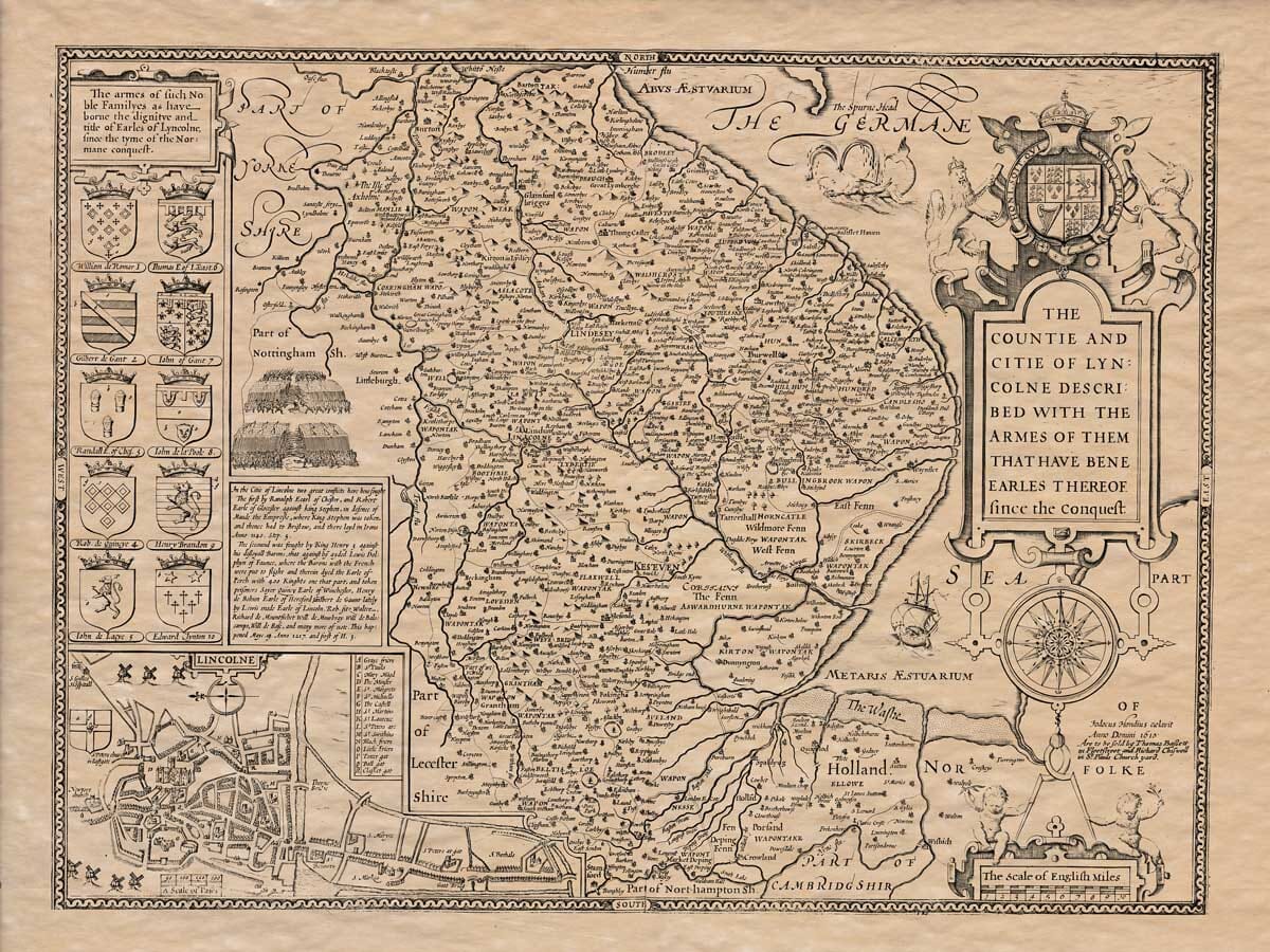
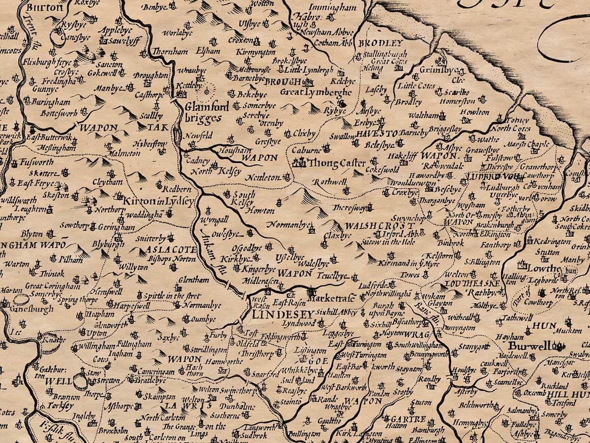
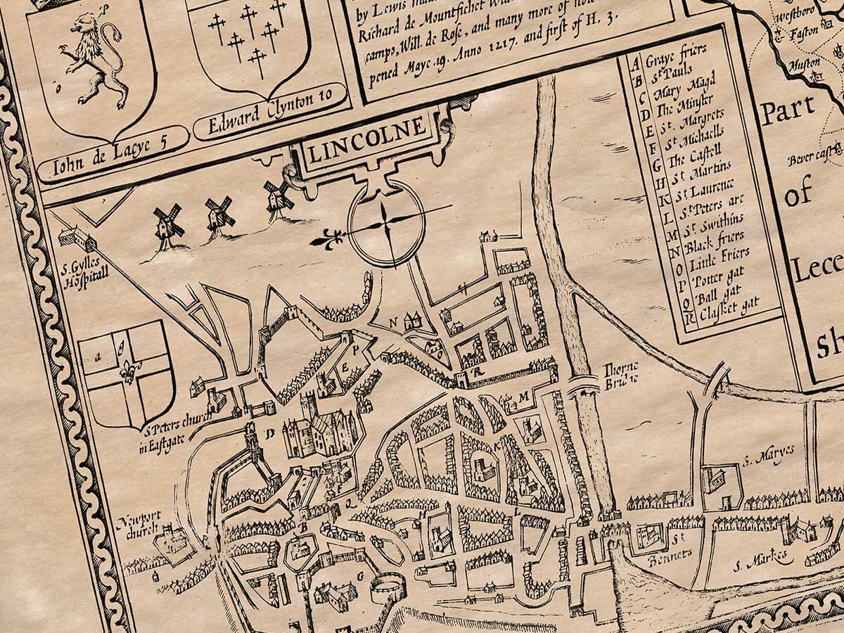
An Old Map of Lincolnshire by John Speed
The Lincolnshire coast with its many inlets, banks and mudflats made it an historically hazardous stretch of water to coastal shipping.
An overall economic depression visited town and country alike in the late 1500’s. But the many churches built at the time and the grandeur of the recently completed churches were an indication of not too distant prosperity.
The map bears ten fine Coats of Arms, these being those of such notable families that have gained the dignity of Earles of Lincolnshire since the time of the Norman Conquest. Intricate illustrations of two important battles also feature with accompanying notes. There is a fine town plan of the City of Lincoln and other features of interest to researchers of Lincoln history include a fine sea monster rising from ‘The German Sea’! A delightful map both in its design and stunning detail.
Available in three sizes: Large: 24″ x 31″ (78.7 x 61cms) Medium: 18″ x 24″ (45.5 x 61cms) Small: 19.5″ x 14″ (49.5 x 35.5cms)
| Dimensions | N/A |
|---|---|
| Size |