Additional information
| Dimensions | N/A |
|---|---|
| Size |
£35.55 – £59.95
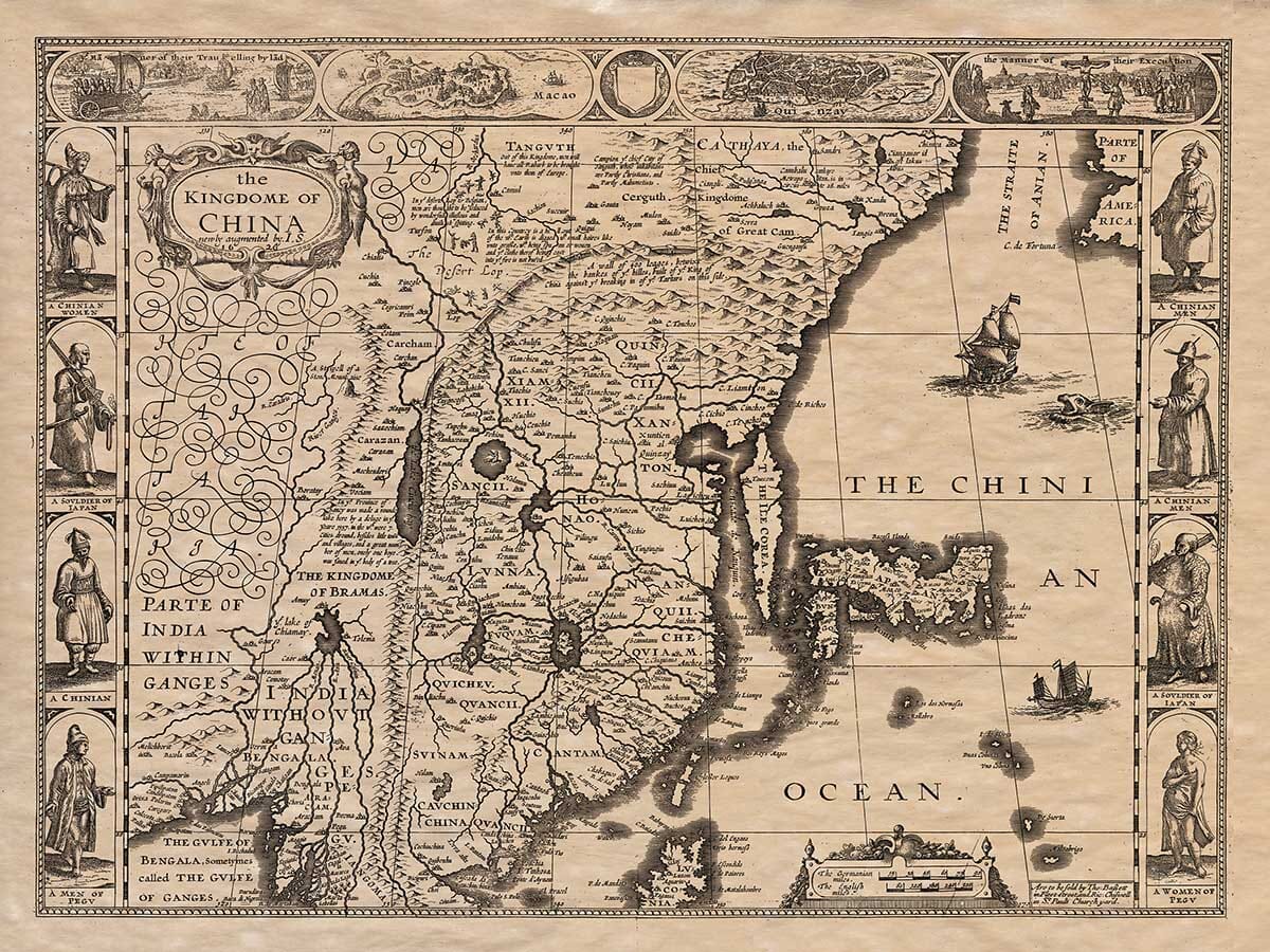
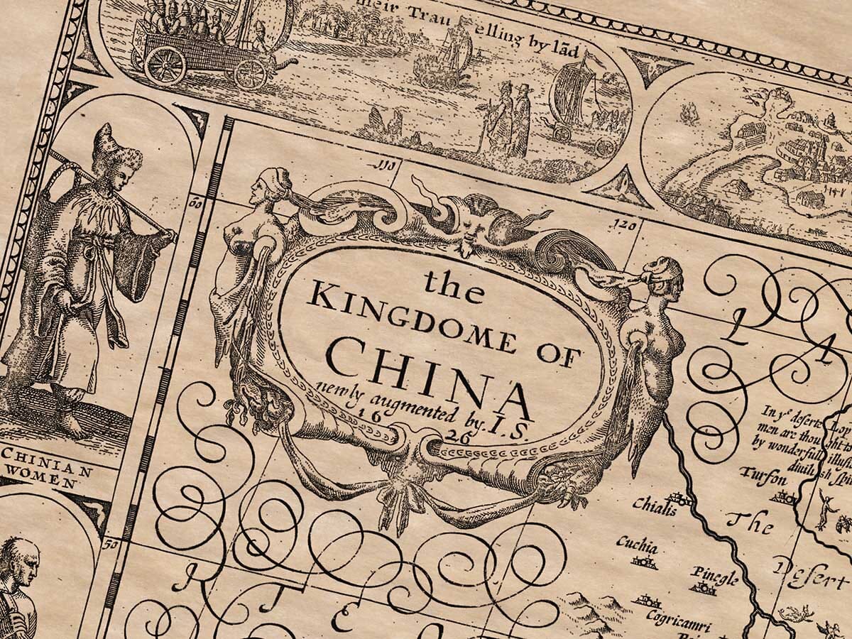
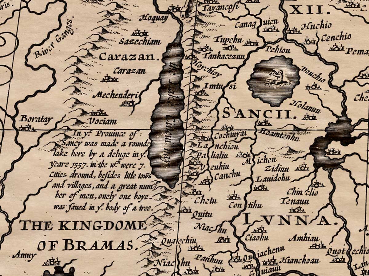
China published in London 1676.
Fascinating and absorbing in its wealth of detail including what must have been the first ‘aerial’ views of these Chinese cities. The borders feature the dress of differing Chinese cultures. To the left can be seen the ‘Part of India within the Ganges’ and to the upper right of the map the Straite of Anian separating ‘Part of America’. Korea and Japan are featured and many small islands, sailing ships and sea monsters abound. A sort after map with originals now selling for in excess of £4,000
Available in two sizes: Large: 24″ x 31″ (61 x 78.7cms) Medium: 18″ x 24″ (45.5 x 61cms)
| Dimensions | N/A |
|---|---|
| Size |